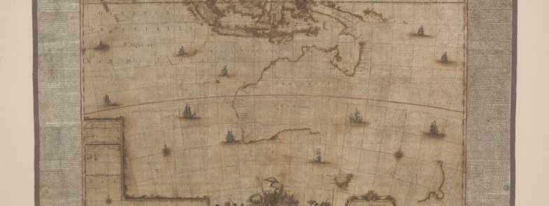
The National Library of Australia is proud to be the custodian of one of only four copies of Blaeu's rare wall map, Archipelagus Orientalis, sive Asiaticus (Eastern and Asian archipelago) 1663.
Director-General of the National Library of Australia, Dr Marie-Louise Ayres FAHA said, “I am delighted that Blaeu’s Archipelagus is the 12th item from the National Library of Australia’s collections to be added to the UNESCO Australian Memory of the World Register.”
“In 2013-14, the Australian public through our annual tax time appeal donated $100,000 for its preservation. This generosity reflects how special this map is to many Australians.”
The map includes details of the first sighting of Tasmania by Europeans, specifically the crew of the Zeehaen in 1642, and the first mapping of New Zealand.”
The map is over a metre and a half wide and comprises six engraved map sheets, including three letterpress panels in Dutch, Latin and French.
A digitised copy of the map can be viewed online. The map is currently not on display in the Library’s Treasures Gallery.